

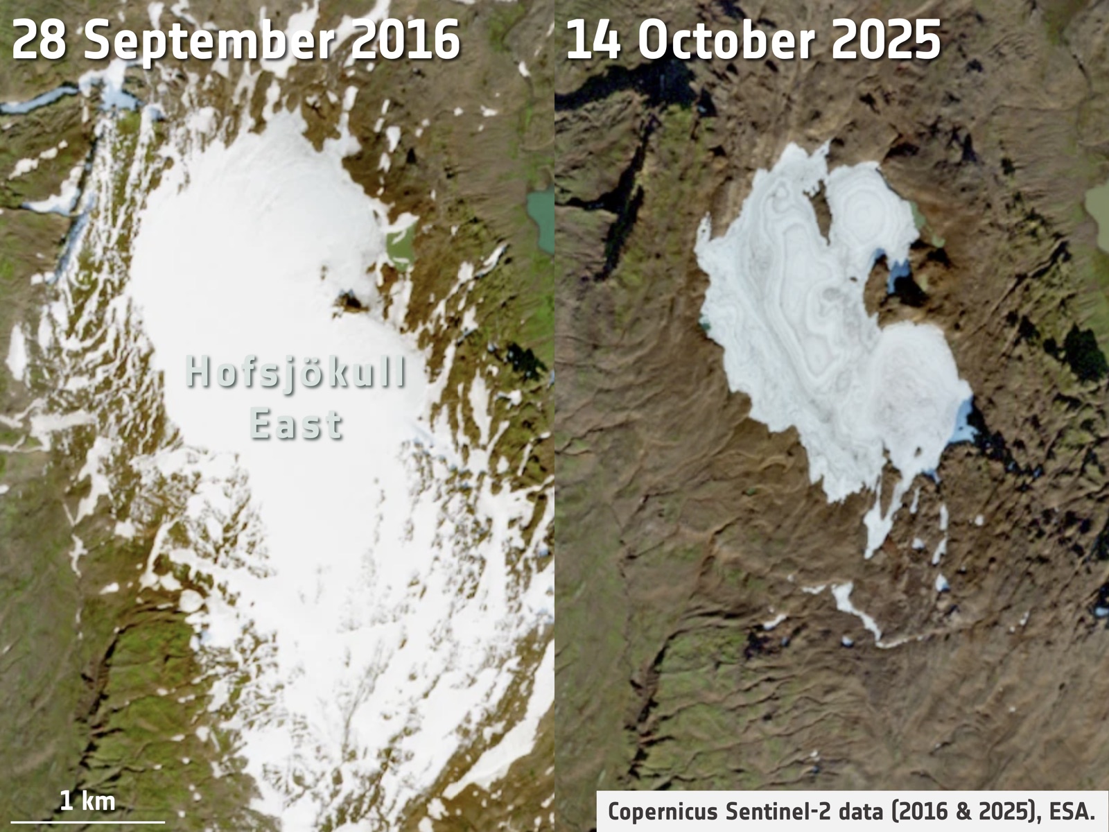
Several Icelandic ice caps lost most or all of their seasonal snow cover in 2025, removing the reflective layer that typically protects glacier ice from melt. CryoSat-2 observations show widespread surface lowering across the ice caps, indicating above-average glacier ice loss.
Glacier Change by Region
Select a region to explore how its glaciers are changing
Source · CryoTEMPO-EOLIS · GlaMBIE · RGI · ESA
Recent News
Explore latest data

The Russian Arctic ranked among the regions with the highest glacier mass losses in 2025, losing 56 ± 37 gigatonnes according to the WGMS Network (2026). CryoSat-2 observations indicate notable summer thinning across the region compared with previous years.
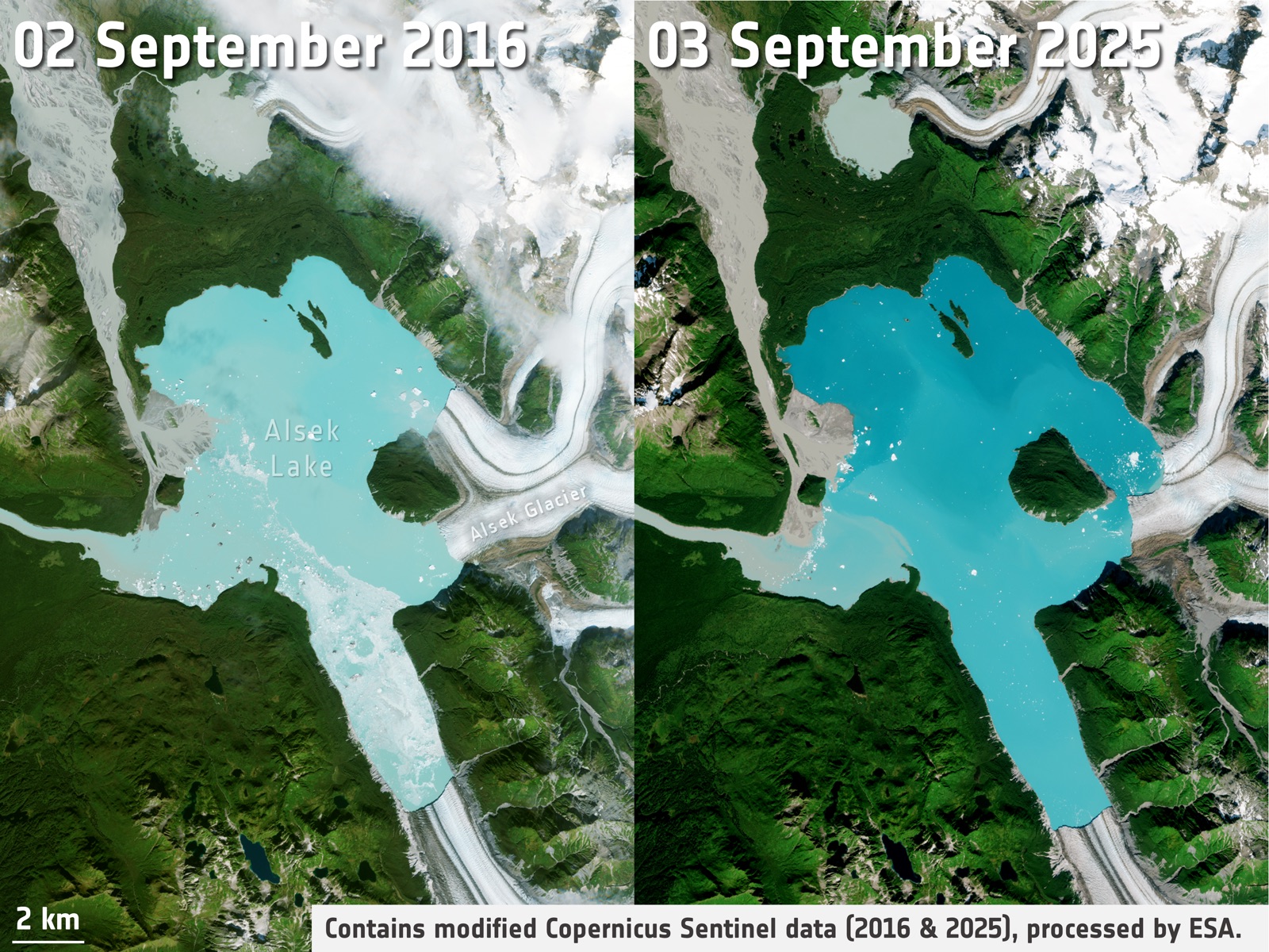
CryoSat-2 observations show that Alaska's glaciers have lost over 8% of their total ice volume since 2000. This rapid retreat is reshaping the landscape - in summer 2025, the retreat of the Alsek Glacier exposed a new island by isolating a small mountain that was once surrounded by ice.
What is Glaciers Today?
Glaciers Today offers a continuous record of the change in volume of the Earth's land ice since the launch of CryoSat-2 in 2010.
Glaciers Today is produced by Earthwave and the University of Edinburgh and is funded by ESA as part of the CryoTEMPO-EOLIS programme.
Why is it important to track land ice changes?
Together, the world's glaciers, the Antarctic and Greenland Ice Sheets contribute to 50 percent of the annual sea level rise and contain more than 99 percent of freshwater ice on Earth. If they completely melted, they would raise sea level by an estimated 67.8 metres.
Long-term satellite data indicate that ice loss is occurring globally and that the rate of loss is accelerating. Volume change results from a combination of the interaction of glaciers and ice sheets with the atmosphere and the ocean.